full view
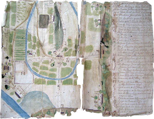
Full view of the Map of Santa María Atzompa, from 1686. This map relates to a dispute over land with the neighboring town of San Jacinto Amilpas. This map was drawn and painted (largely in blue and greens) on thin European paper, stretching over two pages. The paper has deteriorated at the edges and where it folded. [SW]
Vista general, Mapa de Santa María Atzompa de 1686