Skip to main content
The Mapas Project
Toggle navigation
Home
About
Introduction to Mapas
Mapas
Alphabetical List
By Century
Research
Contact
Donate
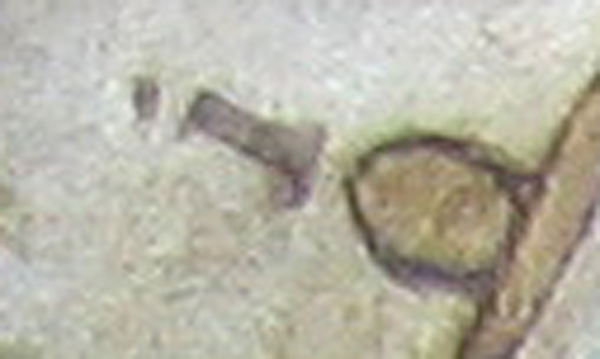
boundary marker, “I”
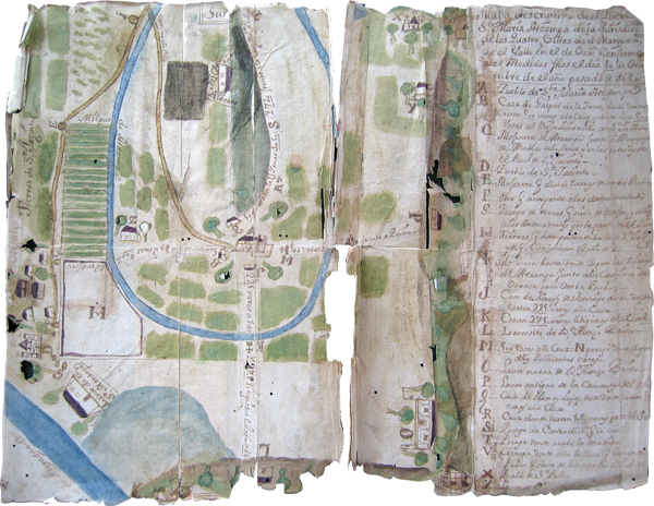
Atzompa, Mapa de Santa María, 1686
boundary marker, “I”
<< Back to Section
This detail shows the item “I” explained on the key to be a boundary marker at the edge of the land pertaining to Atzompa, next to the roads going to Oaxaca from both Atzompa and San Jacinto [Amilpas]. [SW]