Map title (text)
Translations and Transcriptions
English Translation
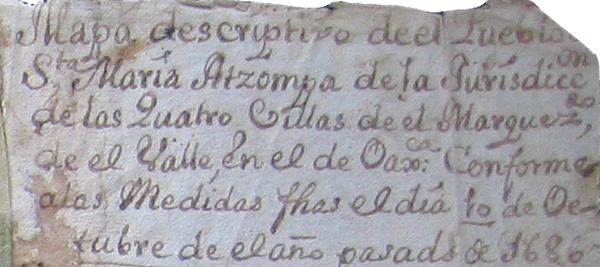
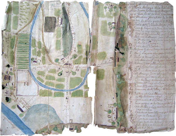
[Spanish-to-English translation by Stephanie Wood:] Descriptive map of the Town of Santa María Atzompa of the Jurisdiction of the “Cuatro Villas” of the” Marquesado del Valle” in the [valley] of Oaxaca, corresponding to the measurements made on the 10th day of October of the past year, 1686.
Analytic Transcription
[Transcription of the Spanish by Stephanie Wood:] Mapa descriptivo de el Pueblo de Sta. María Atzompa de la Jurisdicc n de las Quatro Villas de el Marquezdo, de el Valle, en el de Oaxca: Conforme a las Medidas fhas el día 10 de Octubre de el año pasado de 1686
Image

Locator

English Translation
[Spanish-to-English translation by Stephanie Wood:] Descriptive map of the Town of Santa María Atzompa of the Jurisdiction of the “Cuatro Villas” of the” Marquesado del Valle” in the [valley] of Oaxaca, corresponding to the measurements made on the 10th day of October of the past year, 1686.
Analytic Transcription
[Transcription of the Spanish by Stephanie Wood:] Mapa descriptivo de el Pueblo de Sta. María Atzompa de la Jurisdicc n de las Quatro Villas de el Marquezdo, de el Valle, en el de Oaxca: Conforme a las Medidas fhas el día 10 de Octubre de el año pasado de 1686
Image

Locator
