Item B on the map key
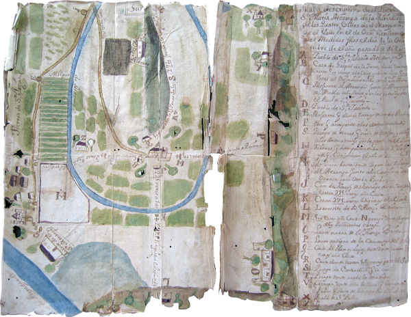
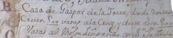
This item (”B”) on the key points to the house of Gaspar de la Torre, from the point where the 500 varas run to the cross, and from the cross, 800 varas to the boundary marker aligning with San Jacinto.
[Note: A vara was the colonial equivalent of a yard or a meter. Towns across Mexico in the late seventeenth and early eighteenth centuries were being measured regularly to ensure that they had their 500 or 600 varas in each of the four cardinal directions from the church that comprised their minimum town base or allotment ensured by law. In 1686, the measurement was still 500 varas, but it was about to be expanded to 600.] [SW]
Lugar “B”