Santa María Atzompa
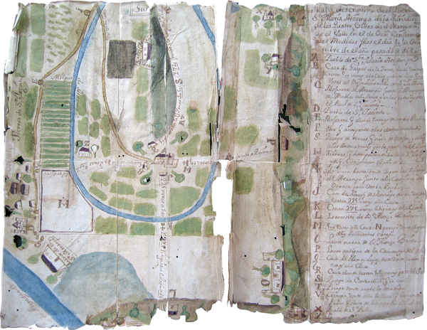
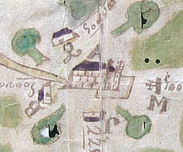
The church at the center symbolizes the town of Santa María Atzompa, marked “A” on the key. This detail also shows several additional letters from the key, relating to the measurements of the 500 varas of the legal, minimum town base in the four cardinal directions from the church. The town base (later called “fundo legal”) was used for more than just the housing core, but also for farming, as this map shows. One year after this map was made, in 1687, the law was changed, stipulating that the measurement be 600 varas and that it be measured out from the most distant houses on the edge of town. (In dispersed settlements, this could help to expand a town base.) But then in 1695 the stipulated town base was decreased again. Although remaining at the figure of “600 varas,” the measurements were to be measured from the church.
One interesting stylistic here is the way the trees are shown as though lying down in the various directions out from the church. This may suggest an indigenous artist who was not as trained in European perspective as the Spanish colonial cartographers. [SW]