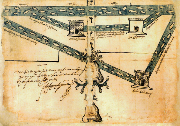
full view, Tacuba map
This is the full view of the pictographic map of Tacuba from 1587. The glosses and texts are in Spanish. The hands vary, suggesting several people participated in the writing. This map relates to a court case in which a don Francisco Tello was requesting access to water for his mill. Apparently there was also a Juan Tello de Guzmán who wished to construct another mill in Tacuba.*
The graphic stylistics are a fusion of pre-Columbian (e.g. glyphs) and European (e.g. three-dimensionality in the doors and windows of the mills). The water at the bottom of the principal glyph is more typical of pre-Columbian stylistics, whereas the river and channels of water to and from the mills lack the shells and curves.
----------
*See: http://www.iifl.unam.mx/wikfil/index.php/Tacuba,_Mapa_pictográfico_de
