full view
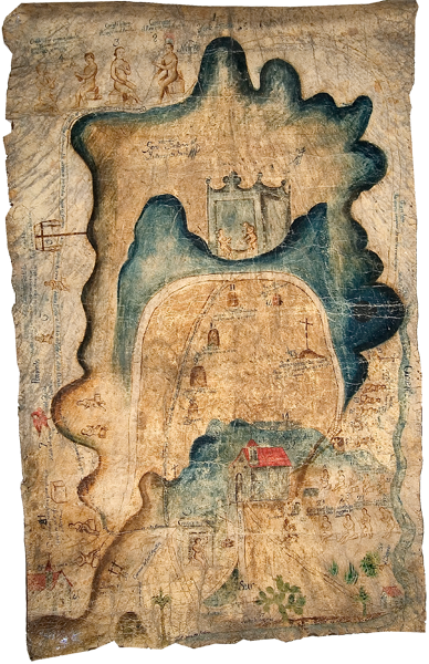
Full view of the Mapa de Mixtepec, which was painted on animal hide. This
“map” documents a legendary origin in Zaachila (at the top), where important ancestors started out on a migration with stops along the left edge of the hide, eventually resulting in a settlement at the location of the largest church with the red roof (center, lower half of the pictorial). There, we see a genealogy spread out across the landscape, documenting the indigenous founding family. Territorial boundaries are marked with mounds in the center portion of the landscape. Neighboring towns, such as we see in the lower left and lower right corners, are important players in the history of the central town, too. Besides routes, mountains and rivers are other important parts of the landscape. [SW]
