full view
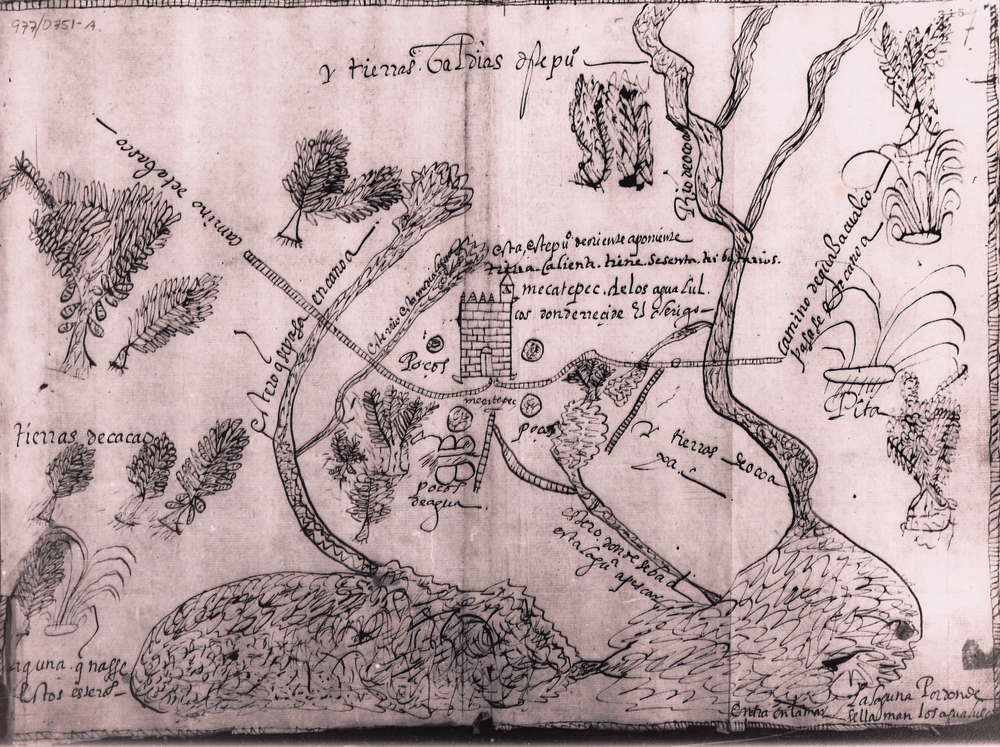
This is the full view of the map that forms part of an file in the Archivo General de la Nación (AGN), Mexico. It is drawn with black ink on European paper. It bears a catalogue number in the upper left corner, 977/0751-A, a reference to the catalogue of illustrations published by the AGN. This map features the indigenous community of Mecatepec, currently located in the state of Veracruz, republic of Mexico. It illustrates a schematic of the village and its surrounding environs, featuring topographical features such as rivers and lagoons, and also aspects of the built environment, such as structures and roads.
vista completa
Esta es la vista completa del mapa que forma parte de un expediente en el Archivo General de la Nación, México. Está dibujado con tinta negra soble papel europeo. En la esquina izquierda lleva un número de catálago, 977/0751, probablemente una referencia al catálago de ilustraciones publicadas po la AGN. Este mapa presenta la comunidad indígena de Mecatepec, actualmente situada en el estado de..., República de México. Muestra....