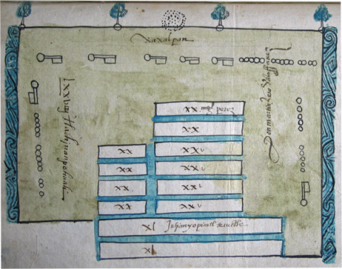
This is a cadastral map of chinampas that belonged to one of the ruling dynasties in Xochimilco, in the southern basin of Mexico (part of the southern end of Mexico City today), in the sixteenth century. Richard Conway is our lead scholar on this project. He will be providing the analysis. This map comes from the Archivo General de la Nación, Mexico, from the collection Vínculos, volume 279, expediente 1, folio 77 verso. ---------- Ellen Heenan, at the University of Oregon, has processed the images using PhotoShop and has inserted them into our Filemaker Pro database so that they could be annotated (2015).
Principal editor:
Richard Conway