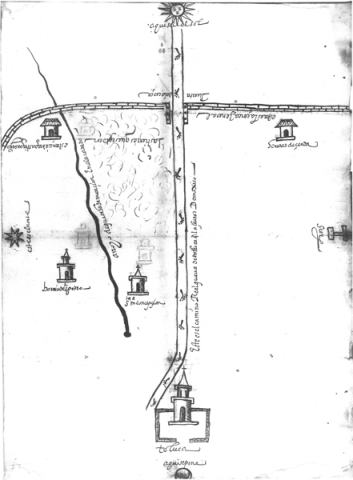
This is a late sixteenth-century map of Toluca and several indigenous communities that were located on both sides of the main road leading to the capital, Mexico City, at least as far as the colonial wall that surrounded much of the agricultural land around Toluca in that period. This map has the look of the maps that were associated with the Relaciones Geográficas, or reports to the Spanish king about local resources, which were produced a few years prior to this one. We learn from a brief text on the landscape that some lands were being “requested,” indicative of a land dispute or of the pursuit of a land grant near the “estancia de Agustín Guerrero.” The footprints on the road suggest an indigenous authorship for the map. Glosses are in Spanish, not Nahuatl, however. ---------- This map is located in the Archivo General de la Nación (México), which kindly made this photograph availble. Its original location was in the collection Tierras, volume 2737, expediente 15, folio 18. Ellen Heenan, at the University of Oregon, has processed the images using PhotoShop and has inserted them into our Filemaker Pro database so that they could be annotated (2016). Analysis of the map is being provided by Stephanie Wood.