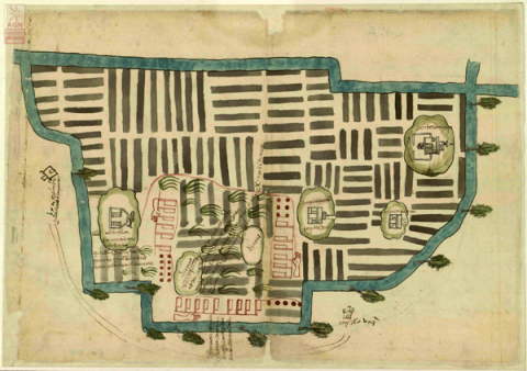
This is a colonial map showing chinampas and the lake environment around Tlahuac (Cuitlahuac), in the southern basin of Mexico (part of the southern end of Mexico City today). Richard Conway is our lead scholar on this project. He will be providing the analysis. This map comes from the Archivo General de la Nación, Mexico, from the collection Tierras, volume 2681, expediente 6, folio 2. We wish to express our great appreciation for the provisioning of the image for this analysis. ---------- Brief description by Stephanie Wood. Ellen Heenan, at the University of Oregon, has processed the images using PhotoShop and has inserted them into our Filemaker Pro database so that they could be annotated (2015).
Principal editor:
Richard Conway